The Isle of Skye, (Scottish Gaelic: An t-Eilean Sgitheanach or Eilean a' Cheò) is located off the West coast of the Scottish mainland, and is the largest and most northerly island of the Inner Hebrides. The peninsulas of Skye are often compared to the wings of a bird; Trotternish in the north, Waternish, Duirinish, Minginish and Strathaird to the west and Sleat are those coastline peninsulas.
The Clan settled in Skye after having lost the ancient lands once occupied on the Isle of Lewis to the MacLeods, and for 800 years lived on the East Coast of Skye just North of Portree. The serene and peaceful peninsula of Trotternish where our traditional Clan Lands are located has many walking paths to include the Scorrybreac Trails.
The following is an extract from History of the Highland Clan MacNeacail, by David Seller.
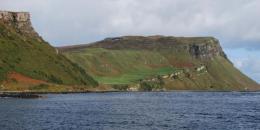
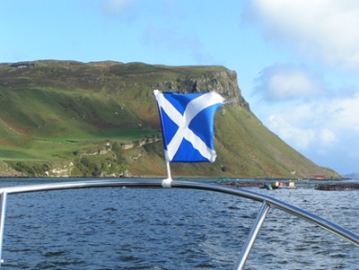
The district of Trotternish lies in the north-east part of Skye and includes the northernmost finger of the island. The scenery here is scarcely less dramatic than that of the Cuillin itself. A long ridge of mountains rises in places to over 2,000 feet. Steep basalt cliffs fall sharply down to more level ground to the east, and then again to the sea. At some points, as at the Quiraing and at Storr, the rock has been eroded into strange shapes and pinnacles, which appear eerie and other-worldly in swirling mist. West of the ridge the ground falls more gradually to cliffs above the sea. In fine weather the views south to the Cuillin, east to Raasay and the mainland, and north-west to the Outer Hebrides are breath-taking. There is a fine natural harbour at Portree to the east, and another at Uig on the west from which ferries ply regularly to Harris and the Uists. To the south of Portree, Trotternish extends to Sconser and Loch Ainort. Ruined duns, brochs and castles punctuate the landscape, mementoes of ancient feuds and former patterns of lordship. The most notable of these is the castle of Duntulm near the point of Trotternish, formerly a stronghold of the MacDonalds of Sleat. The river Snizort forms the western boundary of Trotternish, and there, by Skeabost Bridge, on a small island in the river near the sea, known as St. Columba's Island, can be found the ruins of a medieval church which once served as the Cathedral of the Isles.
Trotternish has been home to the MacNicols or Nicolsons for many hundreds of years. The townships lie mainly on the coastal fringe. The earliest surviving rental, compiled in 1718 for the Commissioners of Forfeited Estates, shows Nicolson tenants scattered throughout Trotternish, especially down the east side and in Braes. The Nicolsons were traditionally known as `Clan Mhic Reacail a bhrochain `s nam potagan eorna' (Clan MacNicol of the porridge and barley bannocks). This may indicate, as Alasdair Maclean suggests, that the Nicolsons once had a greater presence in the rich corn-growing lands in the west of Trotternish than they had by the time of the 1718 rental. The chief lived at Scorrybreac, by Portree. The cliffs at the Bile nearby, at the north entrance to Loch Portree, became known as Nicolson's Rock. According to the First Statistical Account (1794-1795), `The entrance to the loch [Loch Portree] on the north side, presents a cragg resembling Salisbury Craig, and is called Nicolson's rock, from the family which inhabits the farm, who are said to have occupied it since the times of the Danes!'. The outline of these cliffs, viewed from the south approaching Portree, does indeed resemble Salisbury Crags on Arthur's Seat in Edinburgh.
Sellar, W. David, MacLean, Alasdair, and Nicholson, C.B. Harmon, editor, The Highland Clan MacNeacail (MacNicol): A History of the Nicolsons of Scorrybreac

